[ Home ] [ TFF2025Cuba » April 12 ] [ TFF2025Cuba » April 13 ] [ TFF2025Cuba » April 14 ] [ TFF2025Cuba » April 15 ] [ TFF2025Cuba » April 16 ] [ TFF2025Cuba » April 17 ] [ TFF2025Cuba » April 18 ]
First day: Saturday 12.04.2025.
Stops 1-6. Leaving Havana (7.30 AM at street Línea in Vedado and
at 8.00 AM at the Convention Center) and transfer to Viñales (Pinar del Rio) along the Havana-Pinar Highway. Arriving to Viñales
at around 12.00 AM.
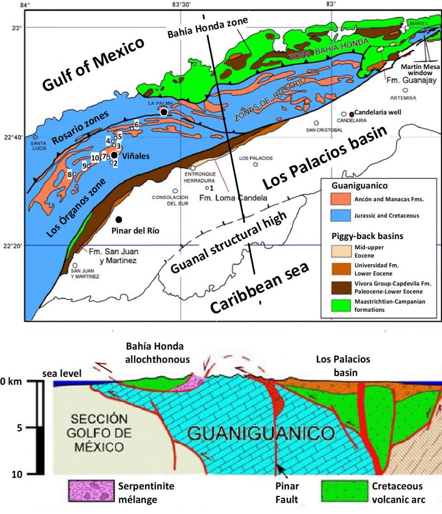
Below: Geological sketch-map and cross-section (black line) of
western Cuba with indication of stops.
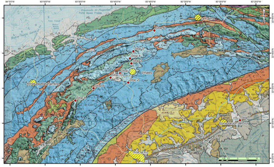
Below: Geological map of western Cuba (1:250000) with indication of stops.
Click here for a high-resolution version.
Click here for
legend.
Stop 1. Parador las Barrigonas. 22°30'25.08", N
83°27'16.43"W. 15 min.
See
on 1:250K geologic map. See
on geologic sketch map.
See on
Google Maps.
Below,
Las Barrigonas coffee shop and tourist stop.

Below, the "palma barrigona", local endemic to western Cuba.

Stop 2. Viñales Geopark visitors center.
22°35'48.30"N, 83°43'10.99"W. Overview of the Viñales
valley and general geology and geomorphology of the region (40 min). Lunch
(40 min). Transfer to the next stop (30 min).
See
on 1:250K geologic map. See
on geologic sketch map.
See on Google Maps.
Here you can find important information about the Viñales UNESCO Cultural
Reserve.

Main exhibition hall.

The exhibit presents posters in Spanish and English.

Overview of the Viñales valley from the Casa del Visitante. On the northern side the Sierra de Guasasa and Sierra de Viñales kartsic mountains are present. This landscape represents a unique example of “tower karst”, with hills named “mogotes”, characterized by vertical walls at least in two of their sides and a rounded top. These mountains are almost hollow inside, as
they contain huge spaces occupied by a network of fluvial-vadose caves.

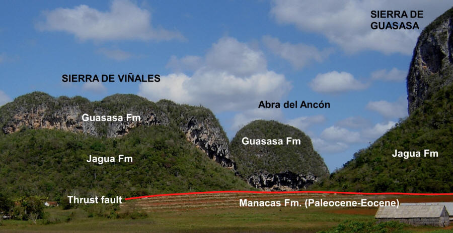
Stop 3. Puerta de Ancón scenic view. 22°38'31.86"N, 83°42'43.97"W. Toward Valle de San Vicente, stop at the intersection with the road to Laguna de Piedra. In this scenic view can be seen the Late Jurassic Jagua Fm and San Vicente member of the Guasasa
Fm. (30 min). Transfer to the
next stop (40 min).
See
on 1:250K geologic map. See
on geologic sketch map.
See on Google Maps.
See on stratigraphic
chart.
Main geologic units of the Sierra de Guasasa and Sierra de Viñales.
Stop 4. Palenque Cave. 22°39'14.14"N,
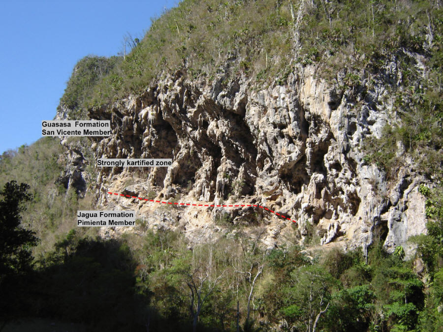
83°42'55.60"W. Inside the Valle de San Vicente, the Late Jurassic (Oxfordian) Jagua Formation features well-bedded shales with laminated fossiliferous limestone concretions (Jagua Vieja member) overlied by well-bedded limestones (Pimienta member). At the top of these limestones lies the Guasasa Formation, starting with a limestone breccia from an onlap event, followed by the San Vicente Member's limestones. These limestones, dated from the latest Oxfordian to earliest Tithonian, are unique to the Los Órganos mountains in western Cuba. They vary from massive to medium-bedded and are partially dolomitized. The lower section consists mainly of micritic limestones, transitioning to some calcarenites upward. Microfacies include various limestone types, though details are obscured by recrystallization, karstification, and weathering. (40 min). Transfer to the next stop (20 min).
See
on 1:250K geologic map. See
on geologic sketch map.
See on Google Maps.
See on stratigraphic
chart.
Overview of the mogote hill with the cave´s entrance.

Principal features observed at Stop 4, Palenque Cave.
Left:
Calcirudite bed at the base of the San Vicente´s carbonate platform.
Right: well bedded beds of the San Vicente platform carbonates

Stop 5. El Indio Cave parking area. 22°40'15.53"N,
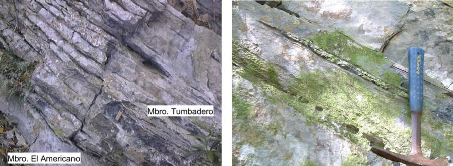
83°42'27.24"W. Jurassic-Cretaceous section. El Americano, Tumbitas and Tumbadero Members of the Guasasa Fm marking the drowning and extinction of the carbonate platform. These members consist of well-stratified limestone containing calpionellids, radiolaria, nannofossils, and occasionally, ammonites. The El Americano Member, up to 45 m thick, comprises dark-gray to black well-bedded limestones and dolostones, resting above the San Vicente Member. A minor unconformity separates El Americano from the Tumbadero Member, which consists of thin-bedded to laminated limestones with black chert intercalations, 20 to 50 m thick. The Tumbitas Member, 40 to 50 m thick, features thick-bedded, compact light-grey micritic limestones with darker limestone intercalations. The Jurassic-Cretaceous boundary lies around the El Americano-Tumbadero contact. (1 hour). Transfer to the
next stop (1 hour).
See
on 1:250K geologic map. See
on geologic sketch map.
See on Google Maps.
See on stratigraphic
chart.
Upper part of the Guasasa Fm with El Americano, Tumbadero and Tumbitas members. The transition between the carbonate platform and the deeper basin

Left: Transition between El Americano and Tumbadero Mbs, circa J-K boundary. Right: Tumbadero Mb micrites with intercalated cherts. In Guaniguanico mountains cherts usually occur since the late Tithonian.
Stop 6. Km 13 of the Viñales-La Palma road.
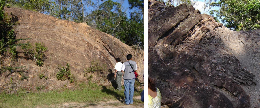
22°43'13.47"N, 83°39'27.44"W. On both sides of the road outcrop the strongly folded San Cayetano sandstones and shales (Lower? To Upper Jurassic early Oxfordian). These folds are inverted (recumbent). The San Cayetano Formation is the oldest known deposits in the Guaniguanico mountains. It represents a sedimentary unit coeval with the early breakup of Pangea in the mesoamerican area, and it is locally cut by dikes and sills of basic igneous rocks. The lithology is sandstones, shales, and rare conglomerates deposited on Laurasian siliciclastic shelf and coastal plain environments. Very low grade metamorphism is present. Landward terrestrial deposits occur in Sierra de los Órganos belt, while more marine dominate the Sierra del Rosario sections. Shallow marine beds are found as intercalations which yield bivalves, and some ammonites to the top of the unit. (1 hour). Departing
to the hotel.
See
on 1:250K geologic map. See
on geologic sketch map.
See on Google Maps.
See on stratigraphic
chart.
San Cayetano´s recumbent folds.

Left: San Cayetano´s antiform fold. Right: San Cayetano´s folded section with tighter folds.
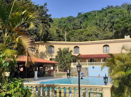
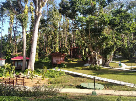
Arriving at hotel Rancho San Vicente and Casas particulares in Viñales
at ca. 6 PM. Dinner at 7 PM. 8.30 PM, after dinner meeting to
discuss the geology of the day.
[ Home ] [ TFF2025Cuba » April 12 ] [ TFF2025Cuba » April 13 ] [ TFF2025Cuba » April 14 ] [ TFF2025Cuba » April 15 ] [ TFF2025Cuba » April 16 ] [ TFF2025Cuba » April 17 ] [ TFF2025Cuba » April 18 ] |