Cuba · Intro

See: Map library of Cuba (free)


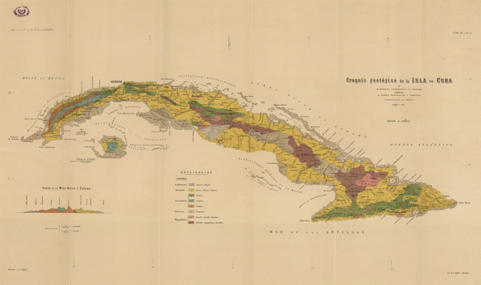
An early Geological Map of Cuba, by Manuel Fernández de Castro and Pedro Salterain y Legarra (1869-1883, CROQUIS GEOLOGICO DE LA ISLA DE CUBA. 1:2.000.000. COMISION DEL MAPA GEOLOGICO DE ESPAÑA, 1883, MADRID. BOLETIN DE LA COMISION DEL MAPA GEOLOGICO DE ESPAÑA; TOMO 8º, LAM. G).

Image source (Instituto Geológico y Minero de España):
http://www.igme.es/internet/sistemas_infor/biblioteca/i_default.asp
http://www.igme.es/internet/sistemas_infor/FondoCartografico/FondoCartoInicio.asp
http://www.igme.es/internet/sistemas_infor/FondoCartografico/CartoIgme.asp?Fichero=http://www.igme.es/internet/sistemas_infor/FondoCartograficoIMG/Cuba1869-1883_I5-8-77.jpg&Titulo=CROQUIS%20GEOLOGICO%20DE%20LA%20ISLA%20DE%20CUBA.%201869-83
(see also: Manuel Fernández de Castro, 1881. Pruebas paleontológicas de que la Isla de Cuba ha estado unida al continente  americano y breve idea de su constitución geológica. Boletín de la Comisión del Mapa Geológico de España, tomo 8, 357-372).

Based on mammalian fossils, Fernández de Castro (1881) showed that Cuba was once linked to the American Continent in the past.


Image source: http://www.geographynetwork.com/ and compilation by García-Casco et al., 2006.

Location. Since the late Eocene, Cuba forms part of the North American plate, which extend south to the Cayman  transform system (the present-day northern limit of the Caribbean plate). During pre-late Eocene times, however, the oceanic rocks and volcanic rocks of Cuba formed part of the leading edge of the Caribbean plate.

Location of mayor cities.


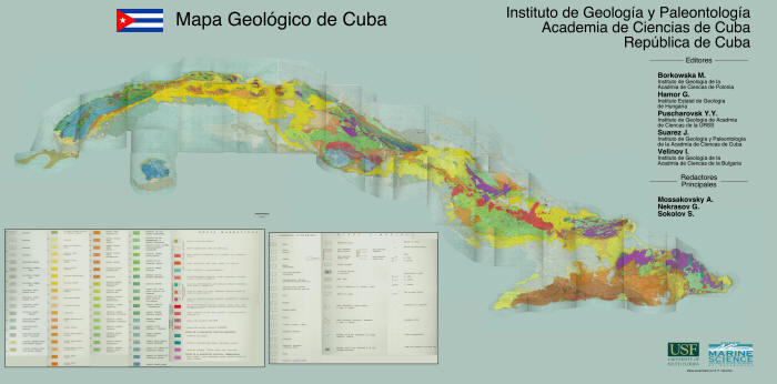
Image source: Pushcharovsky, Y. (Ed.) 1988. Mapa geológico de la República de Cuba escala 1:250 000, Academias de Ciencias de Cuba y la URSS (Geologic Map of the Republic of Cuba Scale 1:250000, Academies of Sciences of Cuba and the USSR). Image assembled using 42 sheets by S. P. Obrochta (University of South Florida, Marine Science).

Geologic Map of Cuba (1:250000). The details are not readily visible in this low resolution image.


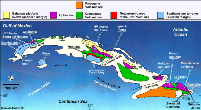
Image source: Modified after Iturralde-Vinent, M.A. 1998. Sinopsis de la constitución geológica de Cuba. Acta Geológica Hispánica 33, 9-56.
http://www.geologica-acta.com:8080/geoacta/MostrarArticlesAGHAC.do?article=aghv3301

Here, the major geologic elements of Cuba are better shown,...


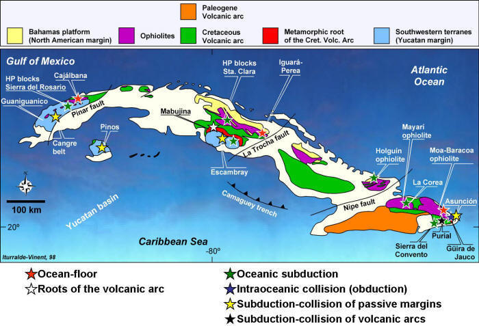
Image source: Modified after Iturralde-Vinent, M.A. 1998. Sinopsis de la constitución geológica de Cuba. Acta Geológica Hispánica 33, 9-56.
http://www.geologica-acta.com:8080/geoacta/MostrarArticlesAGHAC.do?article=aghv3301

and here the main metamorphic complexes, with indication of their tectonic setting of formation can be appreciated.


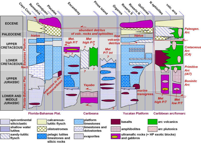
Image source: Modified after Iturralde-Vinent, M.A. 1998. Sinopsis de la constitución geológica de Cuba. Acta Geológica Hispánica 33, 9-56.
http://www.geologica-acta.com:8080/geoacta/MostrarArticlesAGHAC.do?article=aghv3301

Basic lithology and stratigraphy of the major geologic elements of Cuba, with indication of some metamorphic complexes described below.

Note: As compared to the original figure by Iturralde-Vinent and those presented above, in this figure the Escambray and Pinos island complexes, formerly considered as metamorphosed parts of the Yucatan margin, are considered to have formed part of a particular paleogeographic setting termed "Caribbeana" (see: Iturralde-Vinent, M.A. & García-Casco, A. 2007. Caribeana, a possible solution to a long standing puzzle: the Caribbean latest Cretaceous tectonic events. II Convención Cubana de Ciencas de la Tierra, VII Congreso de Geología, Taller de Geología del Caribe, and below).


last modified: 10.02.08 15:51 +0200